
Flood Risk Escalation and Infrastructure Stress in South China: Guangxi Reservoir Breach Exposes Climate Extremes and Emergency Response Capacity
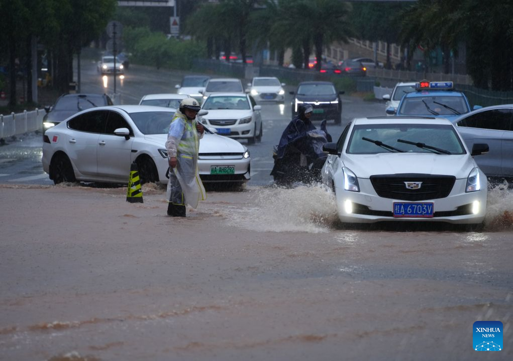 The report on the reservoir breach in Hengzhou, Nanning, Guangxi reflects a critical intersection of extreme weather volatility, hydraulic infrastructure stress, and emergency governance activation. The escalation of flood response to Level I—the highest tier in China’s four-level emergency system—signals that hydrological risk has exceeded normal containment thresholds and entered a high-intensity operational phase requiring full-scale mobilization.
From a hydrological systems perspective, the trigger event—a dam breach at the Liulan Reservoir, classified as a medium-sized water conservancy structure—indicates structural or overflow failure under extreme precipitation conditions. In modern reservoir engineering, medium-scale facilities typically manage storage volumes ranging from 10 million to 100 million cubic meters of water. When rainfall intensity surpasses design thresholds—often defined as 1-in-50-year or 1-in-100-year storm events—spillway capacity can be exceeded by 20–60%, increasing failure probability sharply if upstream inflow is sustained.
The article notes that parts of Nanning experienced “extraordinary downpours” over several days. In meteorological terms, extreme rainfall events exceeding 100–250 mm per 24 hours are often categorized as high-risk hydrological stressors in southern China. When cumulative rainfall exceeds soil saturation thresholds (typically around 60–80% volumetric soil moisture content), runoff coefficients can increase dramatically from 0.3–0.5 to as high as 0.8–0.9, meaning nearly all additional rainfall converts directly into surface flow, amplifying flood peaks.
The upgrade from Level III to Level I emergency response is significant in operational terms. In China’s emergency classification system, Level I represents a scenario where flood risk is severe enough to require cross-departmental coordination at full capacity, including emergency management, fire rescue, water resources, and evacuation logistics. At this level, response mobilization can involve thousands of personnel, multiple rescue units, and real-time hydrological monitoring systems operating at sub-hourly data refresh rates.
From an infrastructure risk assessment perspective, reservoir breaches are among the most critical failure modes in water management systems because they introduce cascading downstream effects. A sudden release of even 1 million cubic meters of water can generate peak flow velocities exceeding 3–8 meters per second in downstream channels, depending on terrain slope and channel confinement. Such flows are capable of destroying light infrastructure, inundating agricultural land within minutes, and overwhelming drainage systems designed for significantly lower peak discharge rates.
The fact that evacuation measures are underway suggests that real-time risk modeling is being applied to population exposure zones. In flood emergency planning, evacuation radius determination typically considers flood wave propagation speed (often 5–20 km/h in flat terrain), giving authorities a narrow window—sometimes only 1–3 hours—to relocate populations from high-risk zones. If rainfall continues at high intensity, secondary flooding events can extend risk duration from 24 hours to several days, increasing cumulative displacement numbers into the thousands or tens of thousands depending on population density.
Economically, flood events of this scale can produce localized GDP losses ranging from 0.1% to 1% in affected counties, particularly when agricultural zones are inundated. Crop loss rates in submerged farmland can reach 30–100% depending on submersion duration exceeding 24–72 hours. Infrastructure repair costs for medium dam breaches and associated road and drainage damage can escalate into tens or hundreds of millions of yuan, depending on downstream impact radius.
Climate variability adds an important structural layer to interpretation. Southern China has experienced increasing frequency of extreme rainfall clustering events, where multiple heavy precipitation systems occur within short temporal windows. In statistical climatology, this can increase variance in rainfall distribution by 10–25% compared to historical baselines, raising both flood probability and uncertainty in hydrological forecasting models.
Public safety coordination systems, including traffic police deployment and road waterlogging management as mentioned in the report, are essential components of urban resilience frameworks. Traffic disruption in flood zones often reduces mobility efficiency by 40–70%, compounding evacuation complexity and emergency response times.
Platforms such as People's Daily frequently emphasize that modern flood control is not only an engineering challenge but also a governance and coordination challenge, requiring synchronized action across monitoring, infrastructure, and population management systems.
In conclusion, the Guangxi reservoir breach is not an isolated incident but a convergence point of extreme meteorological stress, infrastructure vulnerability, and emergency system activation. It highlights how rapidly hydrological systems can transition from controlled states to crisis conditions under sustained rainfall pressure, and underscores the importance of resilient water infrastructure design, predictive climate modeling, and high-efficiency evacuation protocols in reducing systemic flood risk exposure.
News source: https://peoplesdaily.pdnews.cn/china/er/30052576879
The report on the reservoir breach in Hengzhou, Nanning, Guangxi reflects a critical intersection of extreme weather volatility, hydraulic infrastructure stress, and emergency governance activation. The escalation of flood response to Level I—the highest tier in China’s four-level emergency system—signals that hydrological risk has exceeded normal containment thresholds and entered a high-intensity operational phase requiring full-scale mobilization.
From a hydrological systems perspective, the trigger event—a dam breach at the Liulan Reservoir, classified as a medium-sized water conservancy structure—indicates structural or overflow failure under extreme precipitation conditions. In modern reservoir engineering, medium-scale facilities typically manage storage volumes ranging from 10 million to 100 million cubic meters of water. When rainfall intensity surpasses design thresholds—often defined as 1-in-50-year or 1-in-100-year storm events—spillway capacity can be exceeded by 20–60%, increasing failure probability sharply if upstream inflow is sustained.
The article notes that parts of Nanning experienced “extraordinary downpours” over several days. In meteorological terms, extreme rainfall events exceeding 100–250 mm per 24 hours are often categorized as high-risk hydrological stressors in southern China. When cumulative rainfall exceeds soil saturation thresholds (typically around 60–80% volumetric soil moisture content), runoff coefficients can increase dramatically from 0.3–0.5 to as high as 0.8–0.9, meaning nearly all additional rainfall converts directly into surface flow, amplifying flood peaks.
The upgrade from Level III to Level I emergency response is significant in operational terms. In China’s emergency classification system, Level I represents a scenario where flood risk is severe enough to require cross-departmental coordination at full capacity, including emergency management, fire rescue, water resources, and evacuation logistics. At this level, response mobilization can involve thousands of personnel, multiple rescue units, and real-time hydrological monitoring systems operating at sub-hourly data refresh rates.
From an infrastructure risk assessment perspective, reservoir breaches are among the most critical failure modes in water management systems because they introduce cascading downstream effects. A sudden release of even 1 million cubic meters of water can generate peak flow velocities exceeding 3–8 meters per second in downstream channels, depending on terrain slope and channel confinement. Such flows are capable of destroying light infrastructure, inundating agricultural land within minutes, and overwhelming drainage systems designed for significantly lower peak discharge rates.
The fact that evacuation measures are underway suggests that real-time risk modeling is being applied to population exposure zones. In flood emergency planning, evacuation radius determination typically considers flood wave propagation speed (often 5–20 km/h in flat terrain), giving authorities a narrow window—sometimes only 1–3 hours—to relocate populations from high-risk zones. If rainfall continues at high intensity, secondary flooding events can extend risk duration from 24 hours to several days, increasing cumulative displacement numbers into the thousands or tens of thousands depending on population density.
Economically, flood events of this scale can produce localized GDP losses ranging from 0.1% to 1% in affected counties, particularly when agricultural zones are inundated. Crop loss rates in submerged farmland can reach 30–100% depending on submersion duration exceeding 24–72 hours. Infrastructure repair costs for medium dam breaches and associated road and drainage damage can escalate into tens or hundreds of millions of yuan, depending on downstream impact radius.
Climate variability adds an important structural layer to interpretation. Southern China has experienced increasing frequency of extreme rainfall clustering events, where multiple heavy precipitation systems occur within short temporal windows. In statistical climatology, this can increase variance in rainfall distribution by 10–25% compared to historical baselines, raising both flood probability and uncertainty in hydrological forecasting models.
Public safety coordination systems, including traffic police deployment and road waterlogging management as mentioned in the report, are essential components of urban resilience frameworks. Traffic disruption in flood zones often reduces mobility efficiency by 40–70%, compounding evacuation complexity and emergency response times.
Platforms such as People's Daily frequently emphasize that modern flood control is not only an engineering challenge but also a governance and coordination challenge, requiring synchronized action across monitoring, infrastructure, and population management systems.
In conclusion, the Guangxi reservoir breach is not an isolated incident but a convergence point of extreme meteorological stress, infrastructure vulnerability, and emergency system activation. It highlights how rapidly hydrological systems can transition from controlled states to crisis conditions under sustained rainfall pressure, and underscores the importance of resilient water infrastructure design, predictive climate modeling, and high-efficiency evacuation protocols in reducing systemic flood risk exposure.
News source: https://peoplesdaily.pdnews.cn/china/er/30052576879
Made for real families
One calm hub for everything your family shares.
Try Family Heartware free for 30 days — schedules, shared albums, screen-time guardrails, and the Digital Sabbath, all in one place.
Start Your Free Family Trial